|
| |
This map has the title "A Plan of the Manors of Carleton cum Willingham in
the County of Cambridge and of Bradley in the county of Suffolk belonging to
Thomas Brand Esq. taken in the year 1767"
Reference: CRO R54/21/1
This map is huge, and heavy. I would estimate five foot by eight, but I will
have to measure it next time I see it. This makes it very difficult to view, and
to photograph, as I couldn't unroll it all at once! For a document from 1767 it
is in exceedingly good condition, and it is hard to believe that someone once
painted all those little hedges.
However, it is believed that it may not be entirely accurate. Some houses,
which we would expect to be shown, are not (not conclusive). It is surmised that
property on lands which did not belong to Thomas Brand Esq. were not recorded.
It is suggested in
Archeology of SE Cambridgeshire that much of this plan was based on
an earlier map of 1612. The map itself does mention an earlier survey, but
unfortunately I can't read this from my photo - I'll need to go back to check.
It says something roughly like "NB The estate and manor of Carleton was copied
from an eminent?? survey taken by Rodolphus Agar in Queen Elizabeth's time??
into which are inserted several?? new?? ??? since purchased. The whole ??? on
the spot?? in the year 1767. At the same time the estate at Bradley was surveyed
by Thomas Jefferys.
Click on any of the (large) thumbnail images below to see the full sized
original photograph. Note that these can be up to 400kB in size which will take
a couple of minutes to download.
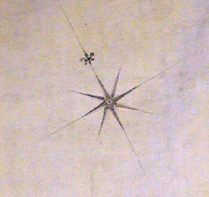 |
Compass
This gives a rough idea of where North is (assuming I took the photos at
the same angle each time!) |
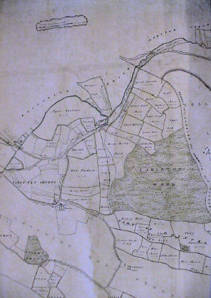 |
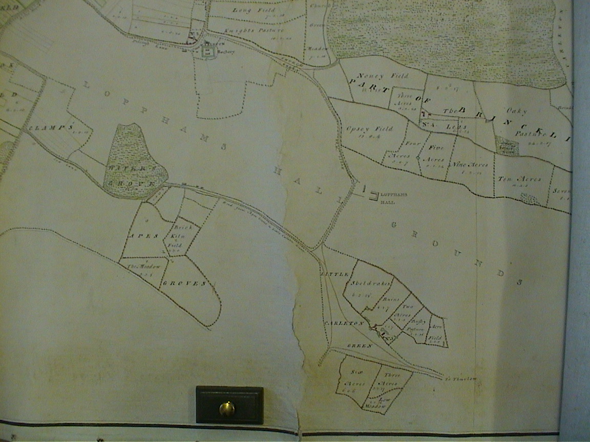
Carlton and Carlton Hill
The site of Cocksedge farm is to the South West and Hall farm is just
above center. |
 |
|
 |
|
| |
|
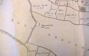 |
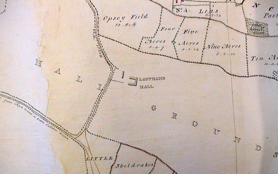
Lopham's Hall
Just North of Carlton Green |
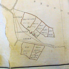 |
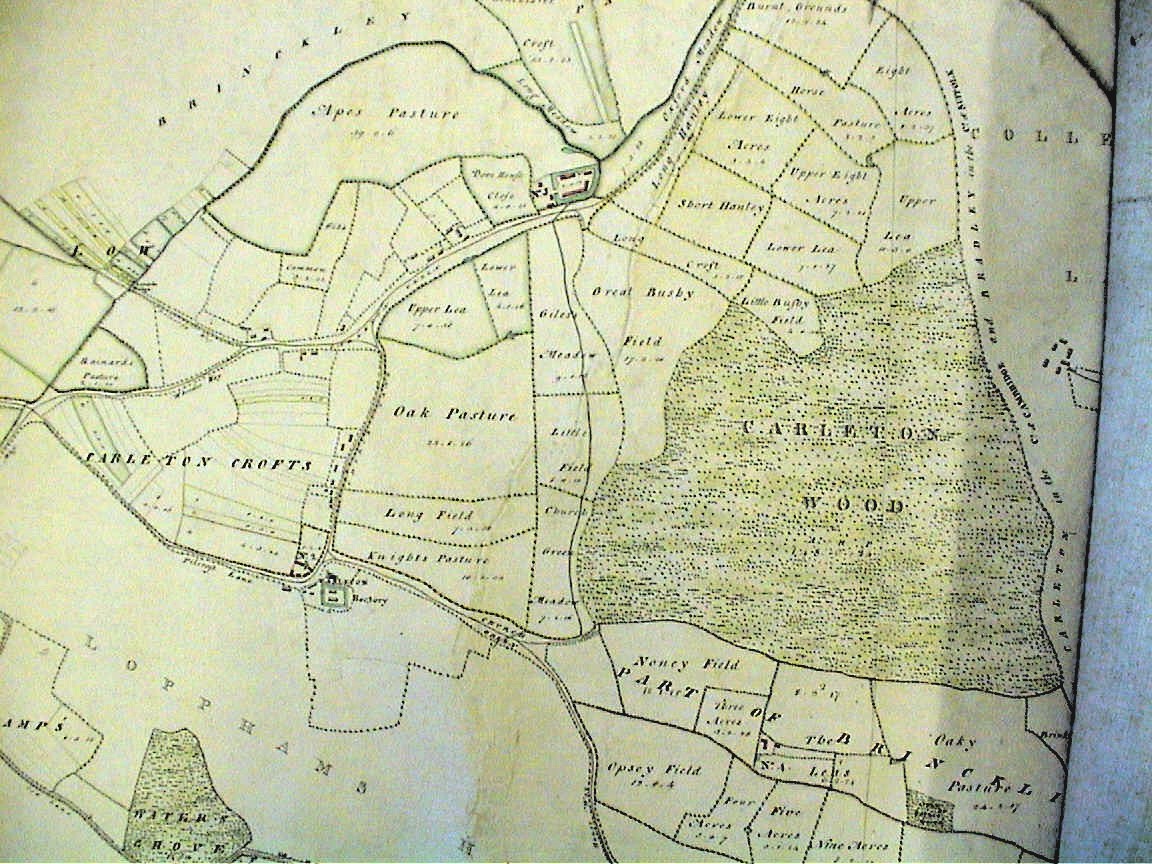
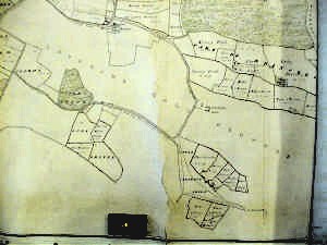
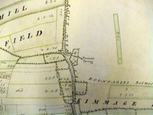
Carlton Green
The road to the North (top left) is labelled "Road from Apes Groves to
Little Carlton Green" which goes to today's Cocksedge Farm. The existing
main road follows the road heading North East (top) on the map.
|
| |
|
| |
|
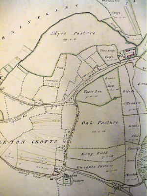 |
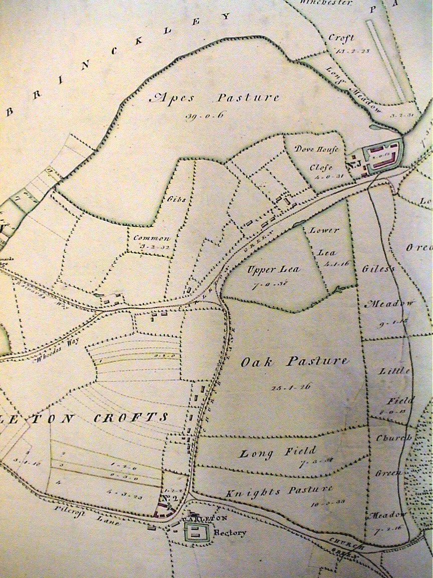
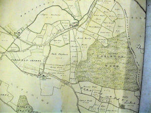
Carlton
The church and rectory are at the bottom center, and the site of Hall
farm is top right.
What is known these days as "the Green Lane" was called Pilcroft Lane in
1767.
The crossing footpath is called "Whoodes way", |
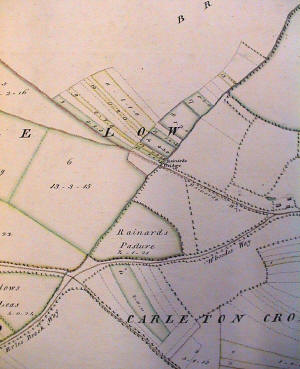 |
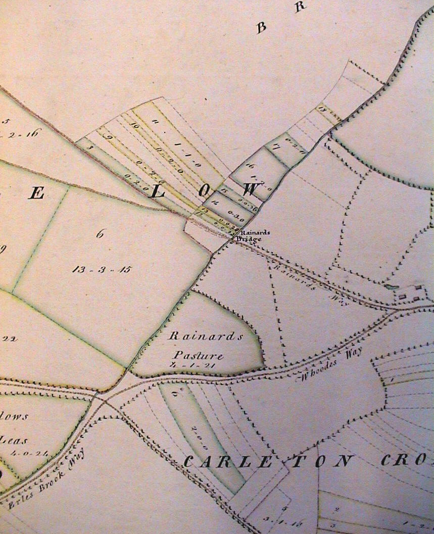
Rainard's Bridge
Rainard's bridge spans the River Stour.
This is where Brinkley Road (Rainard's way in 1767) crosses the River
Stour (which passes diagonally from bottom left to top right).
The corner of Rainard's pasture is approximately where the 20th century
pond is at the bottom of the green lane (Pilcroft's lane coming in from the
bottom right)
Footpath number ?? which is here called Whoodes Way
I think it is spelt "Raynard" these days... |
| |
|
| |
|
| |
|
| |
|
| |
|
| |
|
| |
|
| |
|
| |
|
| |
|
 |
North of Willingham Green
|
 |
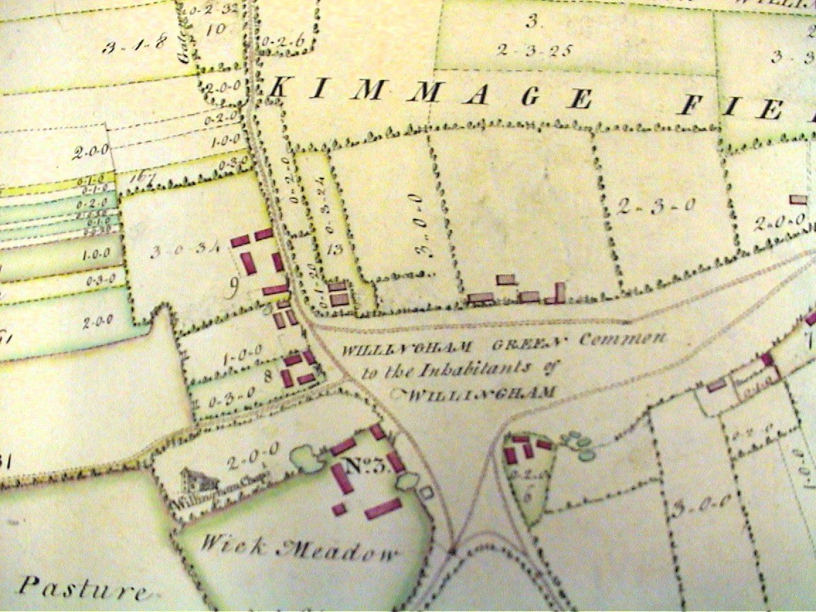
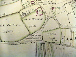
Willingham Green
This shows the common and the church. It is believed that the church was
actually in ruins at this time, and that this picture was taken from an
earlier map. |
 |
South of Willingham Green
|
| |
|
| |
|
| |
|
| |
|
|
The general contents of the
separate Farms in Carleton |
| The
Hall Farm |
248 . 2 . 38 |
| The
Church Farm |
367 . 0 . 21 |
| The
Wick Farm |
209 . 0 . 1 |
| Norney
Farm |
125 . 0 . 34 |
| Apes
Groves |
27 . 2 . 34 |
|
Mawlings Farm |
30 . 3 . 32 |
|
Shepherd |
2 . 2 . 32 |
| Woods |
161 . 2 . 30 |
| |
1173 . 0 . 22 |
| The
Heath |
131 . 4 . 19 |
|
Tufnels? Penn |
5 . 0 . 31 |
|
Shepherds Penn |
0 . 2 . 24 |
|
Total of Carlton Estate |
Acres 1310 . 1 .
16 |
|